This blog covers my Smoky Mountain hikes; it also includes a link to pictures from one of my cross country ski ventures.

Friday, January 27, 2006

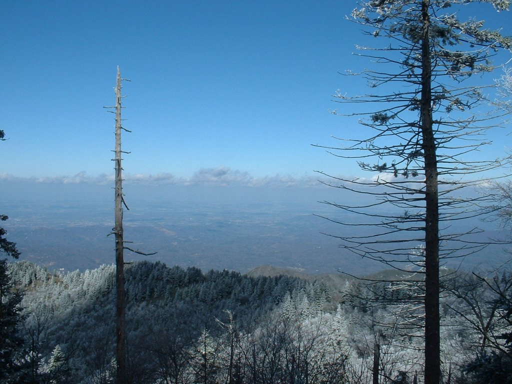
Abrams Falls Trail (to Hannah Mtn, 4.2 + 4.2 mi)


On the 1/25 hike Debbie Way invited me to go with her and a few women to Abrams Falls on Friday; having not been there, I said that I would go. After looking at the map at home, I decided that I wanted to go the additional 1.7 miles past the falls and end at Hannah Mountain Trail (8.4 roundtrip).

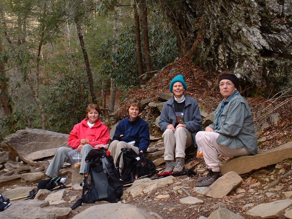
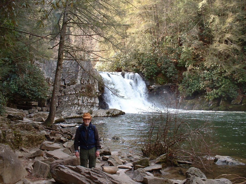
We (Debbie Way, Betty Jones, Martha Sundquist, Martha ? and I) began the hike ~9:40. We arrived at Abrams Falls ~11:00. At this point Betty Jones advised me that she would like to go with me to the end of the trail; this was fine with me for on the 2.5 miles to the falls she impressed me as being quite capable. We took a few pictures and then Betty and I took off; we arrived at Hannah Mountain Trail ~noon and ate lunch. We then took off; after we reached Abrams Falls, we met many hikers going to the falls (it's a popular short hike).

Wednesday, January 25, 2006

Grapeyard Ridge & Baskings Creek (10.3 miles)

The hike was Grapeyard Ridge and Baskins Creek trails (10+ miles). It was unique in that prior to going on any Wed. hike I was with 4 others doing trail work on all of Baskins Creek (3 of us started from West) and first part of Grapeyard Ridge (3 of us starting from East until we met the 2 starting from the West). The hike today was unique from the organizational aspect. Blount Co. hikers met as usual at Food Lion; Knoxville hikers met at a Cracker Barrel in East Knoxville. Initially 5 of us were in my car ready to go when a newcomer pulled up; we switched to Amy's van since she could take 6. We drove to the Gatlinburg Visitor Center. Knoxville hikers would start at Baskins Creek (~start of Roaring Forks Motor Trail); Blount Co. and Gatlinburg hikers would start at Grapeyard Ridge (Greenbrier area). A key swap was made and 3 vehicles went to each trail head. (Although some of our hikers realized it, we had the harder hike for ours started at a low elevation and ended at a relatively high one.) Our group of 10 included Debbie Way & her son, BZ & Bob from Gatlinburg/Sevierville, and Amy, Janetta, Paula, TJ, and Ellie.

Grapeyard Ridge was not too difficult; however, some stream crossings were a challenge because of our recent rains. Baskins Creek had healthy climbs. On the latter one member of our group went a little slow going uphill; I would wait, then put it in high gear when I saw him and before he saw me. Never hiked with him before but I was concerned even though he has hiked much more than I have. Close to the end of the hike I told BZ that I was thinking of doing Laurel Falls and Cove Mountain solo; when Ellie and Debbie heard this they suggested that this be the group hike next Wed. It is neat how those who have hiked all 900 miles try to help people like me.

Wednesday, January 18, 2006

Rainbow Falls, Bull Head to Mt. LeConte (13 miles)


Rainbow Falls Trail to Rainbow Falls & Mt. LeConte (13.4 miles)

Joel Morris and I decided to do this hike rather than the one scheduled for Wed. We left Sugarlands VC ~8:40, drove to S/L 8 in Gatlinburg and got to the trail head ~9:00 through that entry to the Park. Although the day was brisk, my layering was just right. Not sure exactly when we reached RF; we took a few pictures there; Joel remarked that he had never seen that much water at the Falls. (It rained a lot 1-17; some of the early a.m. snow melting in the p.m. added to it.)

We arrived at LeConte ~1:00; this was ~4,000 ft climb so we had to work a little. Although there is a caretaker there somewhere, it is closed in the winter so we just looked at a few cabins and found one that had a snow-free porch so we could eat our lunch. There was a fresh snow cover of ~6 inches. If one wants to stay at LeConte in season,you need to make your reservation ~1 year in advance; three trails lead to it and hiking is the only way you can get to it. (In season supplies are brought by Llamas; food is supposed to be quite good. However, I was told by one who has stayed there that during the evening you might hear mice climbing in the walls.) There is also a shelter there for back country campers.

Trip down was a bit easier; both up and down included numerous creek crossings. Log crossings for the most part but some rock hopping too; you would not want to fall on latter for water was very cold. Trail was often like a shallow creek bed because of melting snow; Gortex lined boots are the only answer. Today I tried my crampons on way down; they provide good security on ice.

Wednesday, January 11, 2006

Little Bottoms, Hatcher Mt., Cooper Rd (13.5 Miles)

Because this hike was in essence a square with Cane Creek one of the sides, I wanted to do the 2.1 miles of Cane Creek that projected from the square to the NW Park boundary (i.e., in and out) or else it would be something that I would need to make a special trip some other date just to complete. Thus I sent an e-mail out to all Wed. hikers to see if I had any takers. Ellie Doughty called me and said that she would hike it with me; she did not need it for she has completed all 900 miles but she wanted to help me (folks really try to help each other in this group--Ellie also said that she wanted a longer hike since she is training to get back on the AT). Derl's group (the Wed. group that does the shorter hikes) also met at Food Lion at 8:00; I ended up taking Janetta and Amy and led the caravan as Amy directed me through a route starting on Montvale that eventually lead us to the West side of the Park at Abrams Creek Campground.

The other hikers were Tom, Dale, Ellie, Liz, two women whose names I do not recall, BZ, and Bob (new to our group). The Brown Book states that Little Bottoms should be taken by only those sure of foot; the fellow leading our group demonstrated that for he took a fall and had he slipped another couple of feet would have fallen off an ~30 foot precipice. After we had done 3 legs of this square route Ellie, BZ, Bob and I turned right on Cane Creek as the rest turned left on the shorter hike back to Abrams Campground. Spent a bit of time talking to Bob; he and I almost crossed paths at NAS Pensacola in the late 50's. It was an enjoyable and relatively easy hike to take after a long lay off.