This blog covers my Smoky Mountain hikes; it also includes a link to pictures from one of my cross country ski ventures.

Saturday, February 25, 2006

Jakes Creek Trail (3.3 in & 3.3 out)


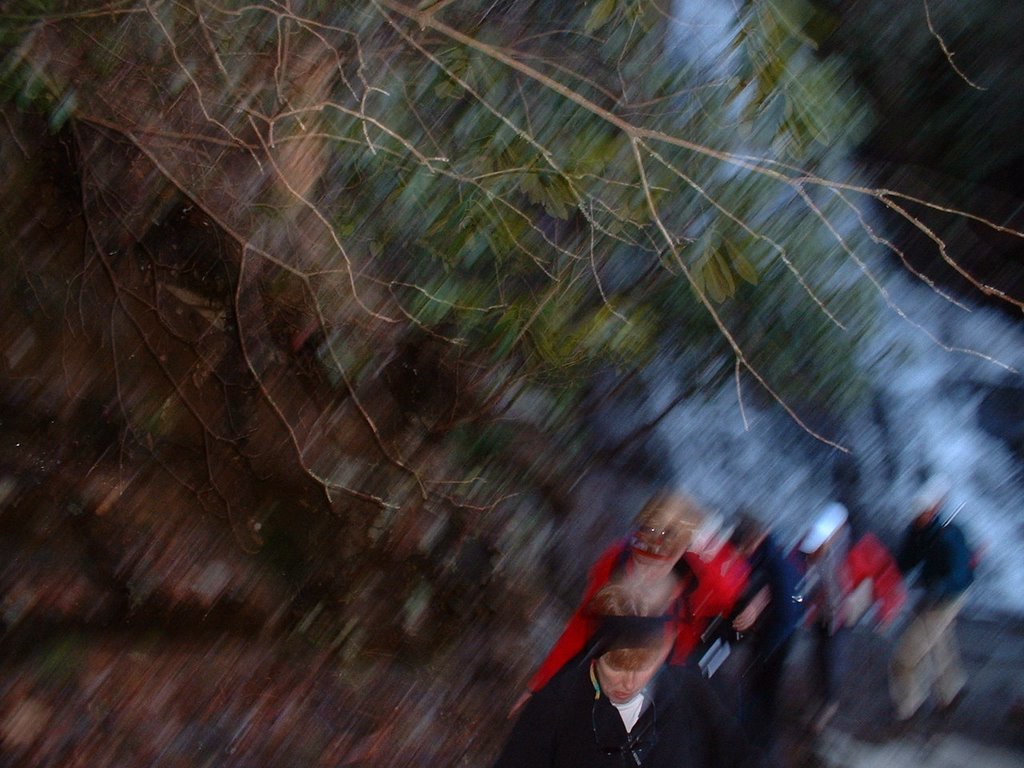
My advertisement of 3 Friday hikes resulted in one taker if I could move one to Saturday. I picked up Anne at Food Lion at 8:00; because I had done West Prong yesterday, we picked Jakes Creek (out of Elkmont) over my remaining choice (Chestnut Top Trail).

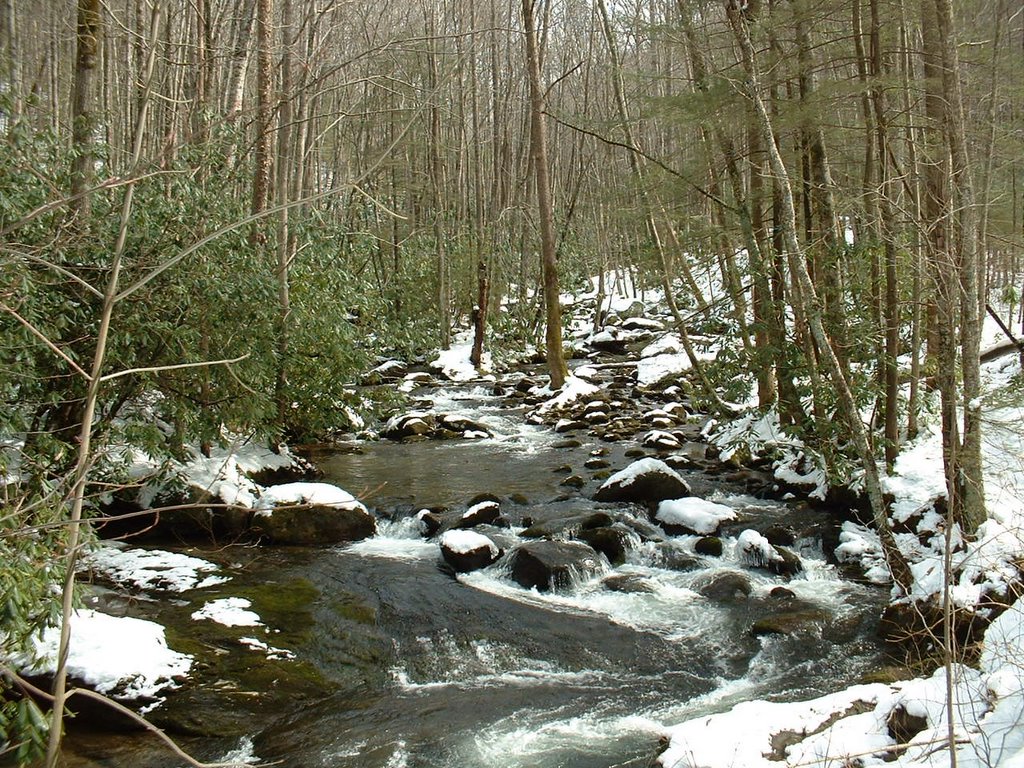
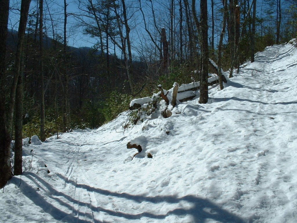
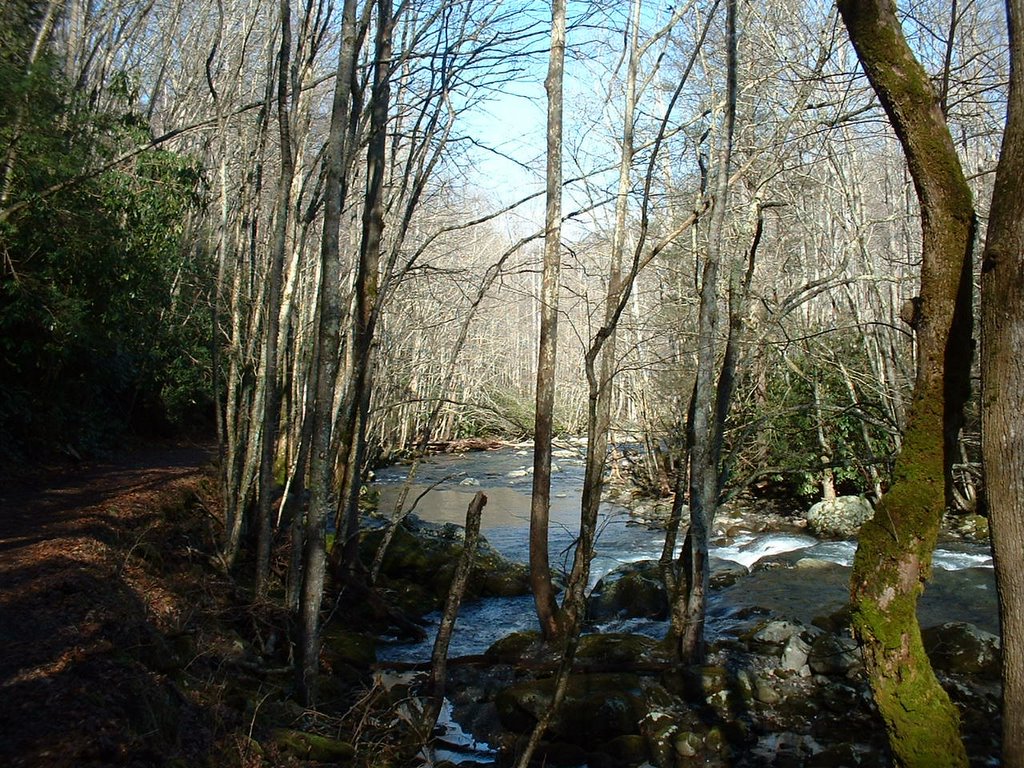
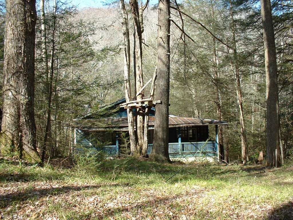
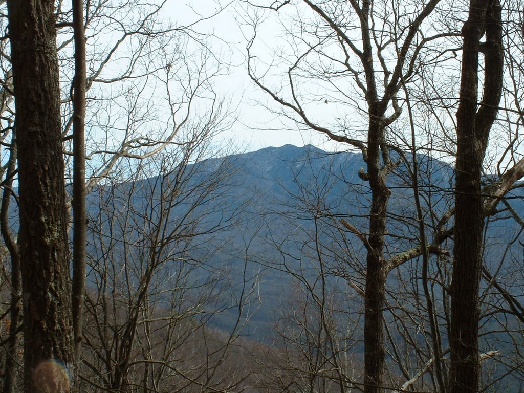
Jakes Creek Trail rises ~1650 ft in its 3.3 mi. length; much of it parallels Jakes Creek and is quite scenic. Because of snow melt and rain, the creek had a good flow and for one crossing in particular we were thankful for our Gore-Tex lined boots. Two campers were at site 27. When we reached Jakes' Gap, the landscape was covered with snow and as might be expected, it was breezy. On the way out I saw another street of deserted houses that I had not (think Anne had not either) seen previously.

Friday, February 24, 2006

West Prong (Out & In from Tremont, 5.4 mi)

Started solo on this one at 10:00. Near the end of the first mile there was a switchback that resulted in my walking on two sides of three deer at a top of a rise; much to my surprise one deer actually started walking towards me.

I was so fascinated by the stream (see Pic) that I passed trail where I should have turned and ended up at Campsite 18. Retraced my steps and one of the two campers who made their own campground fell in right behind me. Reached Bote Mtn Trail at 11:05; as I was having a snack the camper following me (Don) arrived (he was planning to do a clockwise loop beginning at Finley Cane). On the way back I visited his buddy Dick at Campsite 18; I was interested in looking at their tents, etc., for I may do a few overnight hikes to facilitate getting some of the trails. Heard a few good bear stories from Dick.

Trip back also took slightly more than one hour despite my 10-20 min. stay at Campground 18.

Wednesday, February 22, 2006

Rich Mountain Loop Trail (8.5 mi.)


It was rainy when I pulled into Food Lion ~7:45; Ellie arrived shortly and then Marita. When we reached the parking area at the beginning of Cades Cove Loop, Bob (Bolinger) was waiting for us (Bob lives in Sevierville and hence meets hikers in the GSMNP). We were at the trail head at 9:05.

The initial segment of Rich Mtn Loop Tr is level and passes John Oliver's cabin at ~1.4 miles; in the next ~1.5 miles it rises ~1,700 feet. Seemed to be marked changes in temp in the climb and along Indian Gap Trail; it was also very cloudy and pictures taken were not clear. As we started descending down Crooked Arm Ridge the weather cleared quite a bit. The first picture that was clear presents my fellow hikers, i.e., Ellie, Marita, and Bob (Bolinger); the background is Cades Cove meadow. The last picture was taken at the end of our hike facing South; it presents the Cades Cove Meadow at the beginning of the 11-mile motor loop.

Wednesday, February 15, 2006

Middle Prong (~10 mi. but only 2.3 mi. towards the 900)


The hike scheduled for today was designed by Liz to meet specific needs that I had for completing the 900 miles; it included Bote Mt & West Prong, Lumber
Ridge, Meigs Mt, Curry Mt (13.2 miles). Snow precluded doing Bote Mt & West Prong; however, confusion on my part relative to meet-up site precluded doing Lumbar Ridge, Meigs & Curry Mt.

Bob Mysinger drove & Bob (last name??--Boy Scout affiliation) and I were passengers; because we could not find our compatriots (I should have asked where Kinzel Springs was and I forgot where the Back Porch was), we drove back and forth and eventually to Tremont in hopes of catching them there--no luck. I decided that we should not do the scheduled trails because we had not made a key swap and would thus end 9.3 miles from Bob's car. Instead we walked down a closed road in Tremont (~2.5 mi) and then I put it in high gear to do the 2.3 mi. to Panther Creek Trail (P-C sign depicted); it was not particularly easy because of ~10 inches of snow. (On way there I passed Liz, Ann, et al. just shy of Panther Creek; Liz had just expressed concern to her group of my possible whereabouts.)

I then retraced my steps and met Liz et al. again and took pictures for them. In ~0.5 mi. I met Bob & Bob; as we ate lunch Liz et al. passed us. Because the Bobs were not concerned about finishing Middle Prong trail to Panther Creek, we then walked back to Tremont (Middle Prong Creek pictured). Some of the other hikers came in off of the trail when we were at Bob's car with one question: Where were you, Wendell?

Tuesday, February 14, 2006

Ski-Hike 2/14/06


This was orignally planned as just a cc-ski outing. Because all roads in the GSMNP have been closed for a couple of days at low as well as high elevations, a neighbor suggested that I consider entering the park at Wear's cove and then skiing the park road to the Little Greenbrier school road and then play it by ear. Because I thought that this might be too challenging for the novice skier, I only contacted two experienced ones but neither could go.

Parked my car at the Wear's cove entrance to the park (the road into the park was blocked as expected). Although closed to vehicular traffic it had been graded but it was icy; thus I carried my skis and proceeded to walk carefully ~one mile to the to Little Greenbrier school road. Once I had passed this gate (this road is always closed in the winter) I put on my skiis and skied to the school house and then up the road and the side-trip to the Walker sisters' cabin. (Did one stream crossing on skis.)

Upon my return from the Walker sisters I decided to ski Little Brier Gap Tr to its terminus at Little Greenbrier Trail (latter was hiked 2/10/06). (It was not until then that I realized that I had hiked this trail with Bill Woodrick last summer; we had planned to hike to the Laurel Falls trail but one of Bill's friends could not make it.) I carried my skis coming down Little Brier Gap Tr. until I reached the Walker sisters' turn-off. The trail now had numerous bare spots; if I could not avoid all of those (most caused by trip up), at least one ski could stop (not too good a situation). When I reached the park road (now open to traffic), the ~one mile, mostly up-hill, seemed quite long in my ski boots.

Friday, February 10, 2006

Little Greenbrier Trail (4.3 mi. in & 4.3 mi. out)


After I had committed to do an extra hike on Friday, I belatedly sent out word on Thursday that I was going to do Little Greenbrier Trail. Hereafter I must get the word out sooner; although I had four respondents, only Jim Harb could do it. I had hiked with Jim a number of times; he is strong hiker and moreover is savvy on many of the nuances related to hiking equipment. Although I was going to go alone if I had not takers, as I found out this was not the best trail to go solo.

We arrived at Little Greenbrier trail head in Wear's Cove shortly after 10:00; we reached Laurel Falls Trail (our terminus and lunch spot) at 12:30. On the way up we met two single hikers and a group of four women; the latter were an interesting lot. They had evidently not seen crampons like mine that were hanging from my backpack(Stabilicers from LL Bean); at least one recorded info on them. Because much of the trail was snowy and part was quite narrow, I put them on after lunch to get a little more experience with them on our downward trek.

We reached my car in less than two hours; I then used my Ice-Up a second time this week. I am very pleased with results; I have not experienced knee symptoms on either day following this week's two hikes.

Wednesday, February 08, 2006

Anthony Creek, Bote Mtn, Finley Cane, & Crib Gap (12.6 miles)


Hike 2/8/06 (Anthony Cr 3.5, Bote Mtn 3.7 + 1.2, Crib Gap 1.6)

We met at our usual spot (Food Lion). I said that I would drive and my passengers were Bob Hutchins, Bill Woodrick, Liz Etynre, and Ann Phillips.

Met other hikers at trail head in Cades Cove horse camp; three different trail options had been presented with all starting on Anthony Creek. I had done this 3.5 mi. Anthony Creek trail previously; it presents ~1,800 feet of climb to Bote Mtn Trail. (Pic includes Bill Broome and Bill Woodrick; Bob Hutchins is there too (my first hike in the GSMNP was with these vets).

We then went down Bote Mtn trail to Finley Cane trail (3.7 mi.); the picture shown may be Thunderhead Mountain. After we had finished lunch Liz et al. arrived; Liz (she has written a book on strategies to complete all 900 miles of trails) told me that I should go down and back Bote Mtn an additional 0.6 mi. or I would have to do it at a more difficult time. Dale Teague joined me for this 1.2 mi. trip.

When we got back most were on their way down Finley Cane (2.8 mi.). When Liz, Ann and I reached Crib Gap Trail (now there was a contingent ahead and behind us), I decided to put it in a higher gear to catch the front runners (Bob Hutchins, Bill Woodrick, Bill Broome and I believe Manfred Grote); I did close to the end of this 1.6 mi. trail. (At my car I tried out my new “Ice Up” kit; I will now be able to ice my knee after hiking as I do after running.) Liz has planned the 2/15 hike with my trail needs in mind; she, as well as many of the other hikers, are really helping this old neophyte (there was one other hiker today older than me—initials BB).

Friday, February 03, 2006

Little River, Cucumber Gap, Huskey Gap (4.8 new trail miles, hike ~6.3 miles)


Starting last week I decided that I should hike twice each week (i.e., Wed. one with the group and the other at the most convenient time). For this second hike of the week I chose a loop in Elkmont and started out on Little River Trail. Within 50 yards of the trailhead I met a very accommodating deer; look carefully and you’ll see vegetation of some sort in his mouth. The first part of Little River Trail is a paved road that usually is adjacent to the river (2nd pic); it is a very easy trail. After I came to the intersection with Cucumber Gap Trail, I decided to stay on Little River Trail until it reached the junction of Huskey Gap Trail; this section was much more like most trails. I then retraced my steps until I reached the trailhead for Cucumber Gap Trail. While tooling along on the latter for ~1.5 miles (had not yet seen anyone—sort of reminded me of my solo trips to Clingmans Dome on cc-skis), someone yelled from behind—it was a runner. He decided to walk with me for ~0.5 miles; although he had not done all trails in the GSMNP, believe he said that he had completed the AT. As we walked along he pointed out Cove Mtn; that’s where I hiked on 2/1. Cucumber Gap led to Jakes Creek Trail for a short distance. I then reached a paved road and found myself to be in what in essence was an abandoned village; most homes were in dire need of repair as you can see by the picture (Cove Mtn. is in background).

The houses and hotel in Elkmont have not been in use since 1992. At this juncture the decision has yet to be made on whether to tear them down or restore (at least the hotel) as historic structures.

Wednesday, February 01, 2006

Laurel Falls (4, .1 + .1 to fire tower), Cove Mtn (8.4)


The Laurel Falls-Cove Mountain hike (starting at Laurel Falls and ending at Sugarlands Visitor Center) was scheduled at my suggestion. I rode with Ellie and four others from Maryville; at SVC two cars were left and all other cars proceeded the 3.5 miles to Laurel Falls. This was the largest group that I have been affiliated in doing one hike--37 people. The hike to Laurel Falls was somewhat unique in that prior to this past June it was the only hike (this excludes cc-skiing) that I had done in the GSMNP; I am not sure if my two sons and wife remember, but we hiked to Laurel Falls (1.3 miles) in 69 or 70. I took a picture of the falls (1st pic--not good) and shortly after had to remove my sweater; I then put it in high gear and passed all but the 6-7 who led led the pack (climb was ~2700 feet). When we reached Cove Mountain Trail (4 miles), BZ told me that I needed to go to the 0.1 mile to the lookout tower; he and Manfred went with me and then we came back and ate lunch.

Cove Mountain trail would be a great cc-ski trail if there were snow. Initially I went alone but I believe the only ones ahead of me were those who had to move cars from the Laurel Falls trail head back to SVC. I stopped and waited a few minutes and Frank Jaskolka joined me (I work with him and his wife Peggy at SVC on Tuesday). Frank is extremely savvy re the Park; he pointed out specific mountain peaks that we could see (e.g., Mount LeConte--my 1/18 hike, 2nd pic). He also identified a place in the Gatlinburg area that I could park if there were enough snow on the Cove Mountain Trail to cc-ski. The third picture is the valley in which the US 441 from SVC to Newfound Gap lies. (Just looked and my pics are in reverse author; hope that my youngest son know a short cut in fixing it.)

At SVC at the conclusion of the hike Debbie and Liz picked from my map next week's hike; these two are so helpful and accomodating me in meeting my goal.