This blog covers my Smoky Mountain hikes; it also includes a link to pictures from one of my cross country ski ventures.

Wednesday, May 31, 2006

Trilliium Gap to LeConte 8.8 mi. new, 6.5 repeat


My map indicates that I had done 2.3 mi. of the first part of the Trillium Gap 8.8 mi. hike previously; in the total picture that matters little. We returned on Rainbow Falls (6.5 mi. from LeConte--a trail that I had completed three times previously (2 up and one down)--all in snow.

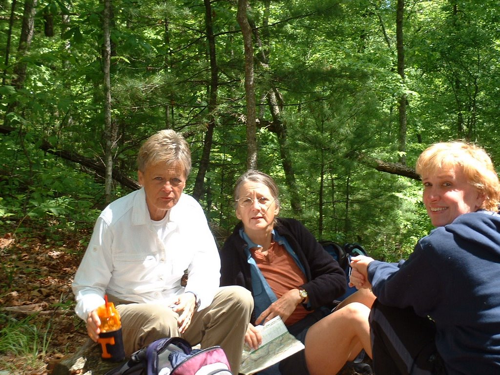
I picked up John Kennerly at the Atlanta Bread Co.; we then picked up Karen at Food Lion and Martha Frink in Walland; Charles joined us at the trail head.

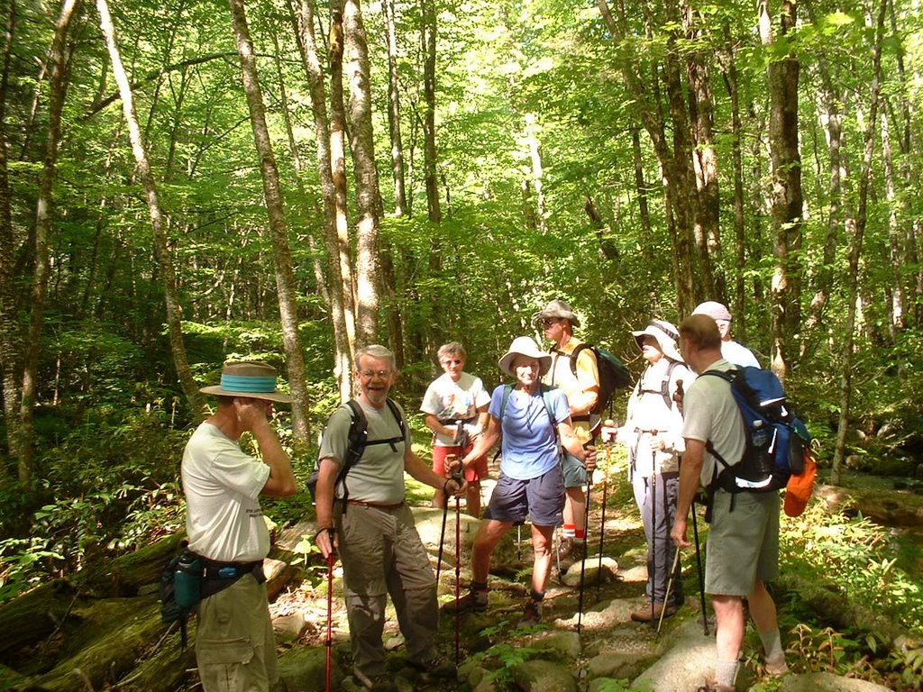
The trip up presented nothing remarkable. (The picture shows three of our group going under Grotto Falls on Trillium Gap Trail following other hikers who were in the vicinity; unfortunately I had a battery problem which precluded showing other pictures.) I led in the last segment; my objective was to get to the top as fast as I could. Three of us started eating at the Lodge and two more of our five were there shortly.

Rainbow Falls, a trail that I had hiked previously in the snow, presented nothing unique. I believe that I liked the snow trips better.

It was a long day; I did not arrive home until ~7:00 p.m.

Saturday, May 27, 2006

Ace Gap (5.6 mi. in & 5.6 mi. out--5.6 mi. new)


Just prior to my start at Rich Mtn. Road 3 pick-up trucks pulling horse trailers arrived; surprisingly each trailer carried but one horse. I talked to the third arrival and he said that they too were doing Ace Gap trail.

I started off at the trail head on Rich Mtn. Road at 9:30. In a short while I met a father and son who had camped at #4; evidently I told him a little about myself (see last para). I reached Beard Cane (the terminus for the 5.6 mi. trail) at 11:22; however, my pedometer only registered 5 mi. This suggests that the trail was very easy and that my stride was longer than I had set for my pedometer.

At 11:37 I had finished lunch and started my return trip. I met the 3 horse riders I spoke of previously and spoke briefly with them. Although I got a picture of the campsite #7 sign, my batteries were too far gone to get a picture of a relatively large house just off the trail on property outside of GSMNP; it reminded me of the house just out of the park on Indian Graves Gap or Scott Mtn. trail, but this one had an exceedingly large and what appeared to be an open gable—perhaps it was still under construction; unfortunately my batteries were too far gone to take a picture. About the same time I noted that my pedometer case was open and of course not recording.

At 1:24 I arrived at the trail’s end; thus according to the map I covered 11.2 miles in 3 hr and 39 min. (after taking off the 15 min. for lunch). This works out to a little better than 3 miles per hour (including stops to talk with 2 hikers and to the 3 horsemen). It would appear that my pedometer is accurate only when there is a good mixture of both up and down trails; in fairly level easy trails as seen today my stride exceeds my pedometer settings.

On the way home I stopped at Little River Trading Co.; ironically the son referred to above had stopped in previously and told Bert (the fellow showing me cooking eqpt.) that he had met a 71-yr old who had just started hiking less than a year ago and that he planned to do all 900 miles of trails; I guess he was impressed that one as old as me would have such a goal.

Wednesday, May 24, 2006

Little River to Campsite 30 (in 6 out 6--3.5 new)


Met at Food Lion at 8:00. There were in essence 4 groups of hikers (Dearl’s group integrated with ours): (1) Little River trail to its terminus at Campsite 30 (my group), (2) those not wishing to go all the way to Campsite 30, (3) those in the former group who wished to do the final part of the hike on Cucumber Gap and Jake’s Creek, and (4) those turning off on Goshen Prong and hiking to Clingmans Dome (a vehicle was to pick them up there).

My group included Anne, Nancy, Dale, Bob & Kathryn, and a new fellow, Allen. The hike was lovely and in essence non consequential until within the last 0.5 miles; here there were 2 serious stream cautions. (Because Bob, Kathryn, and Allen did not have water shoes, they turned around and finished via Cucumber Gap, Jakes Creek, and a short walk through the “ghost town” of Elkmont to the car.) The picture is me standing by the Campsite 30 post.

Wednesday, May 17, 2006

Gold Mine 0.9, Cooper Rd 1.8, Beard Cane 4.2


Only Gold Mine and Beard Cane (5.1 mi. new out of what should have been 13.8 mi. hike)

Met Diane, Amy, and Janetta at Food Lion at 7:00; we proceeded directly to Top of the World Estates SE of Maryville. We left my vehicle on private property a relatively short distance from Gold Mine Trail head at ~7:45.

Gold Mine is 0.8 mi. once you get to it. We then went on Cooper Road (1.8 mi. that I had previously done) until we reached Beard Cane. The latter is 4.2 mi. and ends at the northern most point of the GSMNP in this area. It has a slug of creek crossings with the last one necessitating water shoes (one in our crew almost made it across without). Because latter was only ~0.5 mi. to the trail terminus, I kept my water shoes on for we would be going back the way we came. We reached Ace Gap Trail (our terminus) at 11:10. As we ate lunch (see pic--D, A, & J) a solo hiker completed Ace Gap (5.6 mi. from Rich Mtn Road—he was going in & out--that may be one of my next Fri. hikes). There used to be a trail that follows the park boundary and connects with the end of Cane Creek Trail; we discussed going that way but one other and I were not too much in favor. (A short distance on our way down we met a couple planning on taking that route—they said that they had parked immediately behind me; I sort of wish that we would have for it would have prevented a major goof that I was about to make.)

Shortly after we reached Cooper Road on our return I went ahead with the intent of getting back to my vehicle early so that I could ice my knee and not hold up the others. Unfortunately I did not have my brain in gear when I reached Cain Creek; I forgot where Gold Mine met it and proceeded North on Cane Creek in high gear with my mind on another topic. Unfortunately Gold Mine trailhead was ~0.7 mi. South of this intersection; my prior “orange inking” after the completion of Cane Creek earlier in the year had obliterated this factor. When I eventually came to my senses I am sure that I went more than half of the 2.1 Cane Creek Trail; thus I kept it in high gear and retraced my steps and eventually found Gold Mine. Amy, Diane, and Janetta took my gross error much more in stride than did I. My only solace was that we beat the couple that we met on the trail back to our vehicles—perhaps what was a former trail may have been a very tough one.

Friday, May 12, 2006

Low Gap 2.5, AT 4.7, Snake Den Ridge 5.3


Met Joel at the Cosby entrance to the GSMNP at 7:45 (I left at 6:05, got a sandwich & gas); I was 20 min. early and he arrived before I did. We drove into the Cosby Campground and began our hike ~8:00.

Low Gap was not that unique; on the AT we met a number of hikers. Most had spent the night at Tricorner Knob; they said that it snowed during the night. I shot a number of pictures trying to capture "snow" on May 12. Snake Den Ridge was obviously mostly down hill; I lengthened my sticks in an endeavor to take compressive force off of my knees. We arrived at our cars a little before 3:00; Joe took off and I iced my knee for 15 min.

Tuesday, May 09, 2006

Chimney Tops (1.1 new; repeat 0.9 Road Prong, 4 mi.)


Because rain is forecast for Wed., I decided to do a short Tues. hike solo. I ended up doing the Chimneys; I had previously done Road Prong with BJ and Bob; thus this hike added only 1.1 mi. to my quest.

Passed a few people on Road Prong and then a couple on Chimney Tops Trail; we were confused at a junction because on the trail itself said something to the effect of stop, do not take this trail and a similar one had the same thing. I thought that I saw a washed-out trail and proceeded on it; that was a mistake but I still reached trail (on the way down I did it the correct way).

Eventually arrived at the Chimneys; the picture depicts 4 young people eating lunch. There were also two more in their group who were scaling the rock itself. On the way back I met a host of hikers, including a few who had taken the same wrong path that I did.

Wednesday, May 03, 2006

Thomas Divide (13.6 mi. new, 1.1 road)


Several cars left Food Lion at 7:45; I drove and my passengers were Bill Broome, Mike Miller, TJ Olnas, & Dale Teague. We reached the trailhead for Thomas Divide (below Newfound Gap in NC) ~9:15. Bill Woodrick set pace initially; when he stopped I led the way and we hit our planned lunch spot (junction of Sunkota Ridge Trail) at 11:00. I iced my knee there as we paused for a few minutes; our specific group (John, Dale, BZ, Judy, Pam & I) decided to go on on Thomas Divide and eat our lunch at 12:30. Some proceeded to go down Sunkota Ridge and a later group followed us.

Except for a stretch of uphill as we stayed on the Divide the trail was fairly level; however, the last part was going down the mountain. (This did a number on the 2nd toe--my longest one, of my left foot. We reached the trail end ~3:00; that is where the group picture was taken by John; from left to right they are Pam, BZ, me, Judy, and Dale. We then strolled in on a usable road (~1.1 mi.) to the Deep Creek picnic area where the bus was to pick us up.

Because there were 20+ hikers, the bus only cost each one $6.