This blog covers my Smoky Mountain hikes; it also includes a link to pictures from one of my cross country ski ventures.

Wednesday, July 28, 2010

Post 900 Hike #114: Ramsey Cascades 4 & 4

Yesterday I had volunteered to do the 25 miler from Newfound Gap on the AT & Snake Den Ridge to Cosby because I was concerned that only two might do it; I like to see at least three on every hike. However, this hike was cancelled; rather than do any of the other 4-5 group hikes scheduled for today (my 2nd choice was a 20+ mi. hike), I decided to do Ramsey Cascades. It is one of the few trails that I have only done once; more importantly it could provide a good indicator of my ability to resolve my left-foot problems.

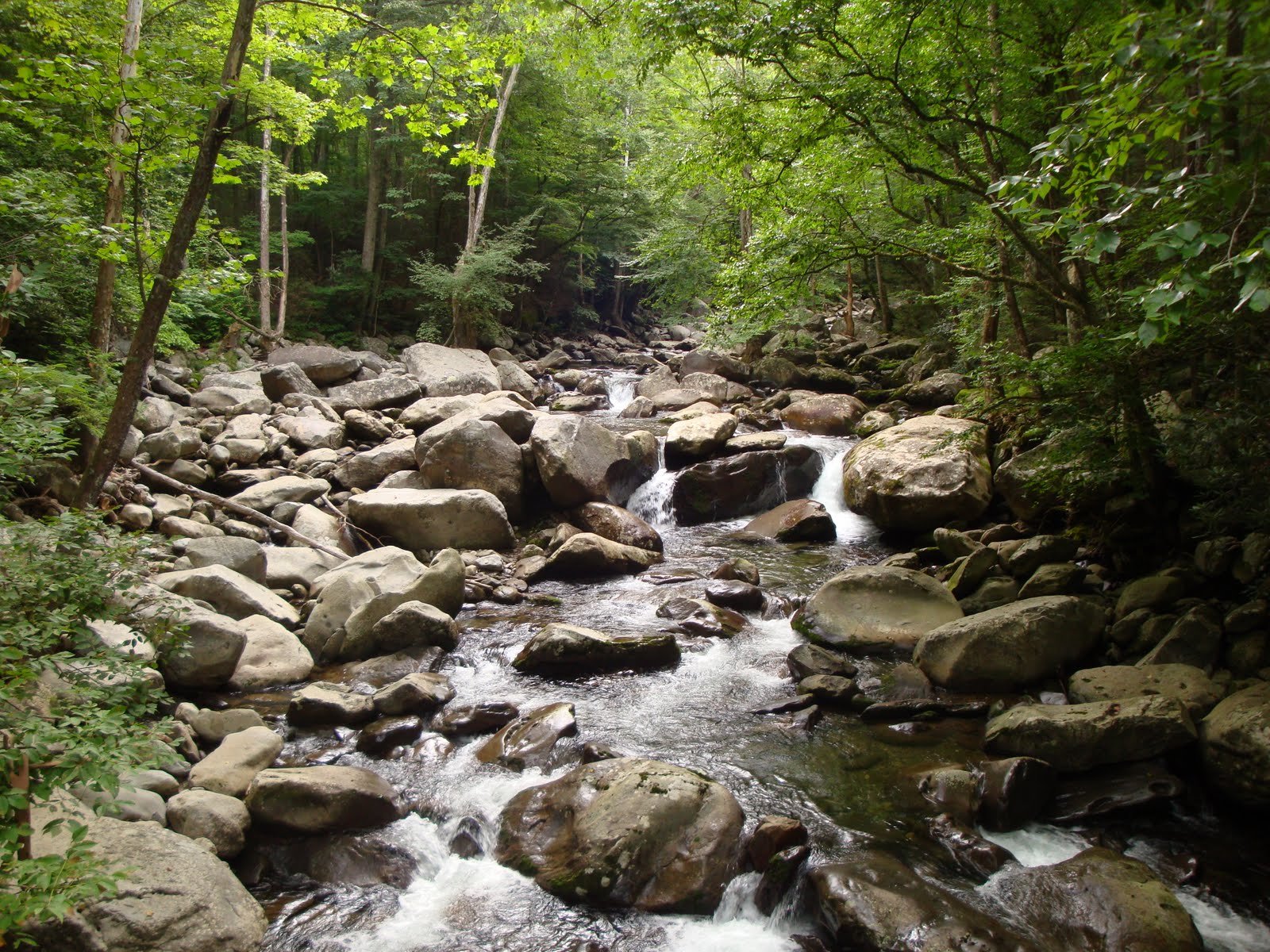
I started on the 4-mi. trail at 09:12; the first part of the hike is relatively easy as the trail was originally a road along Middle Prong and the Little Pigeon River. The first picture was taken from a foot-log bridge looking upstream on MP.


I stopped shortly after this to administer 1st Aid to my left foot. (It did not really bother me again until some of the downs on my return trip.) Ramsey Cascades Trail becomes narrow and at times steep when it follows Ramsey Prong; in some cases trail crews have built very nice rock steps. I had forgotten about the “ups” on this trail and did not think it is was worth wearing my HR-monitor; had I done so I am sure I would have pushed more to get my HR up 150. Although 150 theoretically exceeds the max HR for one my age, my heart appears to be in pretty good condition (at least it is in much better shape than my L-foot).

I arrived at Cascades and the trail’s end at 10:55; guess my time was not too shabby in that it included my 1st Aid stop and because the trail is not considered such an easy one. One gent from OH was recumbent on a very large boulder at its base; soon a young man, his son and nephew from PA arrived (had seen them earlier). Hiking in the GSMNP is an annual event for them. The next picture is of course the 90' Cascades.


I started my trek down at 11:20; on the way down I met scads of folk coming up in groups of 2-5 (I warned a few of the relatively rough terrain ahead--at the cascades they'll see a big sign indicating that 3 lost their lives there). A few very large Tulip Poplars still exist in this area that were not targeted by the lumber companies ~90 yrs. ago; the two youth from OH are standing in front of this one to give a perspective of its size.


I was alone the last couple miles of my venture; I could accelerate a bit more for the down-parts were not steep. At 13:10 I arrived at my SUV and then iced my knee prior to starting my drive home. For this hike I drove ~100 mi.

Trivia Data Collected: 16958 steps taken, 12575 of them aerobic, 634 kcal burned (Note: down steps were far less aerobic, a major difference being that in going up I push hard but in going down I take it quite easy particularly on steep parts.)

Wednesday, July 21, 2010

Post 900 Hike #113: Fork Ridge--5.1, Deep Creek--9.6

This was my firt hike in 3-weeks; my left foot/boot problems were the reason for the rest. It was also why I chose to wear my really broken-in boots (believe I had a good 2,000+ mi. on them). I chose to do this hike because originally only Doug Jerger and Melanie Harmon were scheduled to do it; they are both working on their 900 and I like to see at least three people on each hike.

Arrived at Food Lion ~06:15; at 06:30 left with Doug and David as passengers. We arrived at SVC at 07:20; Bob Bolinger joined us and we set out for the Fork Ridge trailhead which is ~4.2 mi. from Newfound Gap on the Clingmans Dome Rd (that trailhead is also the point that I aim for on X-C ski ventures when there is not enough time to make it to the Dome). At the trailhead Debra Barton, Melanie Harmon, and Gracia Slater (had never met or hiked with her) joined us (David went with the car that dropped the others off for his hike starting on Clingmans Dome).

The 6 of us were on the trail at 07:20; it was at this point that I realized that I had forgotten my pedometer. [Even though I had my good HR-monitor (I look at it primarily on serious ups--this hike was basically down), my pedometer data like kcal burned with my HR on serious ups (in addition to mileage) are the kind of info that I use to drive me; thus with the absence of technical data along with my foot problems, I felt that this hike was destined to be a bummer.] I had done Fork Ridge in-and-out at leat 3-times previouly.

We finished Fork Ridge <11:00; it then took us a few minutes to determine the best place to cross Deep Creek (water shoes were necessary). This is a very compatible group; everyone can move. We stopped at Campsite 54 for lunch; from L-R they are Bob, Debra, Melanie, Doug, and Gracia; the latter two were planning a longer sojourn rather than take just Deep Creek trail.


It started to rain as we finished lunch but stopped before I got my poncho on. Debra, Melanie, and Gracia led (each is a very strong hiker); Bob, Doug and I got a little interested in a fresh bear track. In the picture presented to get a better perspective of size, Bob placed his hand by it (that's no small hand--it is commensurate with Bob's 6'4" height). This is a front paw print; a rear-paw one would have a much greater length with sort of a human-like heel.


Although I planned to go with Doug and Gracia on their slightly longer sojourn, just prior to reaching their cut-off trail I decided that so doing might be a little too much for my L-foot. For the last 3-trail miles Debra and Melanie led; they really moved. After we got on the road, we met countless tubers going to an upstream starting point; obviously all of my prior hikes in this locale were not in the summer for I never saw so many tubers (this locale is on the very edge of the GSMNP--tubes are acquired from private venders).

We arrived at the picnic shelter ~16:00; a few who had taken a shorter hike were already there. My L-foot did not look too bad; the gel "toe sleeve" that my podiatrist gave me did the trick for my middle toe; however, my L-boot opened further at the bunion site (hereafter I will retire my LL Bean Cresta boots (Italian)and use my new Aslos (made in the Ukraine). I also iced my knee. John Slater picked up Gracia and Doug so that they did not have to walk a lot of road (John & Gracia live in nearby Silva NC). It was quite interesting talking to John; both he and I were on active duty in the Navy and retired while in the Naval Reserves as O-6's.

The bus from the Cherokee Indian Reservation came ~17:20; then it was on to Bryson City and then back into the GSMNP to pick up the other hikers on Lakeview Drive by The Tunnel. Then back to Bryson City, the seemingly long drive to Cherokee, then back on US 441 to Newfound Gap; one solace was that those who rode in my SUV could get out by the Fork Ridge Traihead. However, we still had a long ride down the mountain to SVC, dropped Bob off, then on the winding River Road to Metcalf Bottoms, and then the initially winding U.S. 321 to Food Lion in Maryville. I picked up a salmon dinner at Captain D's and arrived home ~20:40.

Thursday, July 15, 2010

Announcement

It has come to my attention that at least one attempt has been made to view my blog since the June 30th entry. I apologize; two minor orthopedic problems made hiking a little too problematic. Please be advised that I definitely plan on doing a "tunnel" hike scheduled for July 21; I decided to do a hike needed by Melanie Harmon (& possibly Doug Jerger--he may be doing it just to help Melanie) in part because I like to see a minimum of three on each hike. (This hike will end at Deep Creek rather than the tunnel on Lakeview Drive (i.e., the Road to No Where); therefore the bus will be picking us up prior to picking up the tunnel hikers.)

Followers of my blog have noted that very seldom do pictures of me appear since I do not take any of me or let others who offer do the same. My picture has appeared when Bob Bolinger has taken it; however, he in essence is a professional photographer and has taken some most excellent pictures despite my presence in a few. At our little get together this past Wednesday in honor of Margret Stephenson--the founder of our hiking group, John Kennerly took some pictures and forwarded this one to me. Since I have sort of been chastised for not including a picture that one can recognize as being me in my blog, I decided to include include this one for in it our also a few of my best hiking friends. From left to right they are: John Hutsenpillar, BZ Lane, yours truly, Richard Ryburn, and Doug Jerger.