This blog covers my Smoky Mountain hikes; it also includes a link to pictures from one of my cross country ski ventures.

Wednesday, August 26, 2009

Post Hike #82: Anthony Creek, Albright Grove, AT, Twentymile, Wolf Ridge

I awoke at 0420, 25 min. earlier than intended. Although I am certain that my Airedale Terrier Winston heard me, my wife didn’t even hear the garage door. In part to decrease Winston’s attention, I chose to eat at the Hardies within a few hundred yards of our 0600 meet-up point; because of their price and quality, I will find excuses to eat breakfasts there again. By 0600 those doing this hike (Leslie Toney, Richard Ryburn, Vicki Watkins, Charlie and I were ready to leave in Ellie Doughty’s van. Ellie, along with 6-8 in other vehicles, had chosen to do the first two trails (500 & 1800 ft. of gain) and then loop back to their vehicles.

This was Charlie Woodward’s last hike for qualification for The 900 Miler Association; it was Anthony Creek—1.6, Russell Field—3.5, AT from (a) Russell Field Shelter to Doe Knob—6.4 and (b) the section that Charlie needed to complete his map, Doe Knob to Twentymile—3.1, Twentymile—2.6, and Wolf Ridge—0.5. In part because (1) Charlie’s quest has been beset with more obstacles than those most faced and (2) this hike was somewhat onerous and less likely to draw hikers, I volunteered.

We started at 0700 and I finished Anthony Creek at 0733; started Russell Field at 0735 and I finished it at 0855. Despite pushing to get an aerobic workout I never got my pulse above 144; because I had a similar experience on Mt. Sterling last week but got my HR to a comfortable 154 the week before on Sugarlands Trail, possibly my lifting weights too late in the evening before these last two hikes was the reason (need to research this more). Met a through hiker at the Russell Field shelter at the junction of the AT; he advised us of bears on the AT. The picture that Teresa took includes some of the loop hikers and most who completed the hike with Charlie; from left to right are Leslie, Emma, Charlie, Ellie, Jane, Vicki, Lloyd, and me.


The rest of the hike was mostly downhill. Richard was having knee problems so I hiked with him; he is (1) taking over the scheduling for me when I go to France and (2) is a very sharp guy who often has answers to some of the problems that I have (this time it was relative to one of my lawn mowers and the consideration of switching to a heat pump and using lake water as a coolant). In the last section of the AT I thought that I better check with Charlie, Vicki, and Leslie to ensure that Bob Bolinger would be there to take Charlie’s picture when he finished at the Twentymile Trail junction. As I approached Leslie, she and Vicki were in deep discussion and did not hear me. Not sure what possessed me but I let out my best impression of a bear growl; Leslie let out a blood curdling shriek! When we got to the trail junction, Bob, Janetta Baker, and Amy Howe (who hiked in from the Twentymile Ranger Station, our option 3 for hikes honoring Charlie’s achievement) were there.

Those that hiked this 3.1 mi. section of the AT (the only miles that Charlie needed out of the 19.6 mi. hiked) are in this picture. From left to right it is me, my dear friend Leslie, Charlie, Vicki, Richard.


We reached Twentymile Ranger Station close to 1700; Charlie’s wife (and mother-in-law) were there with a big cake and sodas. This really hit the spot! I chose not to ride in the same vehicle as Leslie on the way back; it’s a good thing that I’ll be out of the country for a little while, perhaps when I return Leslie will have forgiven me. Arrived at Food Lion at 1850; I sped off to a meeting at Messiah Lutheran Church in Knoxville that started at 1900. Fortunately the agenda item for which I was responsible was a ways down the list.

Wednesday, August 19, 2009

Post 900 Hike #81: Mount Sterling, Mount Sterling Ridge, Balsam Mtn, Gunter Fork, Camel Gap, & Big Creek (19 mi.)

I picked up Cecil at 0630, John Kennerly at 0635, and we proceeded on I-40 to Cracker Barrel at the Strawberry Plains exit. Eight of us were to do the long hike (19 mi.); about the same number were going to do a 12+ mile hike. The three of us also stopped at the Shoney’s on US 321 North of Cosby; I had planed to pick up Dennis McAdams but he was not there. (I subsequently learned that although we were late; Dennis arrived shortly after we had left.)

After we arrived at the Big Creek Campground (our end point), Charlie Woodward (who had organized the hike that we were taking) drove us to Mount Sterling Gap, where we, and those who were doing the shorter loop hike, would start (someone in the latter group doing the loop hike would return Charlie’s SUV to our finish point where my SUV was parked).

At 1002 both groups started on the 2.3 mi. Mt. Sterling Trail; as I often do I started out in the lead; Judy (from NC and one who I had added to our 200+ hiker list at the request of Sharon, Smoky Scout, from Charlotte, whom I had helped arrange a hike back in March) was with me. Judy, an RN (or RN+) hikes a little with our group; she also hikes with North Carolinians. Although Mt. Sterling Trail is only 2.3 mi., it has ~1500 ft. of climb. I had planned to get a good aerobic workout; however, after a brief rest I went ahead and only got my HR to 147 BPM and reached Mt. Sterling Ridge Trail at 1056 (although the trail has a bit of up, they are not continuous and my HR always dropped prior to the next serious up. Our next trail was the 5.3 mi. Sterling Ridge Trail; when we reached the Pretty Hollow Gap Trail junction, Judy et al (including Ellie, John H., and Lowell) went on their assigned route; fortunately I was able to determine the next two hikes during this time. I believe that we ate lunch shortly after this; in the picture our group was Cecil, John K., Frank, Charlie, Jerry Roddy, Vicki, and Richard Ryburn.


I did not record the time that we reached our junction with the 0.9 mi. section of Balsam Mtn Trail that we were to do. Our next trail was the 4.1 mi. Gunter Fork Trail; a trail that is to be avoided in rainy weather (several signs indicating warnings because of stream crossings). I might add that it is a trail that flat-out should be avoided because it is dangerous; for a stick user your right one gets little real use because the trail drops precipitously on the R-side. I was glad that the rain hit us when Vicki, Charlie and I (who were in the lead) had almost finished it. Although the stream crossings were not always a piece of cake, they were not difficult. When we had to cross Big Creek close to its terminus, we donned our water shoes. The three of us in the lead then proceeded about 75 yds. to Camel Gap Trail; at this point I thought that we should return to the Big Creek stream crossing to give those following us some pointers.

After this we were on Camel Gap for only one mile; I moved ahead for I wanted to finish and be able to ice my knee prior to the others finishing. Here the trail signage became a little confusing; at 1645 I reached the sign indicating that I was on Big Creek Trail and had 5.1 miles to go. I decided at this point that I wanted to finish by 1800, so I started moving a little faster than those who were immediately behind me. Not sure how long but less than one mi. I reached another sign indicating that I had 5.1 miles to go. That did not deter me from my goal; I kept it in high gear. In retrospect I should have stopped to take a picture of the falls and also of some of the gigantic rock that were in Big Creek (i.e., the trail parallels the stream); however, although fatigue was not a problem and the trail was boring, my goal of finishing it by 1800 was paramount. Somewhat to my surprise I finished it at 1747; since this was ~30 min. prior to Charlie’s and Vicki’s arrival, I had much more time than I needed to ice my knee. Believe Cecil came next; John arrived shortly thereafter with Jerry. The latter advised us that Frank and Richard had availed themselves of a nice respite in Big Creek; in retrospect I too perhaps should have availed myself of the opportunity to enjoy the moment. However, I am somewhat driven to do everything quickly; since I reached age 75 a little more than two weeks ago, maybe one of these days I will do a better job of enjoying the moment rather than just finishing quickly.

Wednesday, August 12, 2009

Post 900 Hike #80: Sugarland Mtn. Trail (12 mi.)

The hike for today was Sugarlands Mountain. John Hutsenpiller, Richard Ryburn, and Joan Tomlinson rode with me from Food Lion; we picked up Jerry Roddy in Townsend. We then proceeded to Fighting Creek on Little River Road. John H., Joan, John Kendrick, Cecil Rowe, BZ Lane, and I proceeded North on the 12 mi. Sugarland Mountain Trail. The other hikers (Richard Ryburn, Jerry Roddy, Teresa Wu, Ann Phillips, BJ Perlack and her daughter) proceeded to the Northern end of Sugarlands Mtn trailhead, just across Clingmans Dome Road from Fork Ridge Trailhead; they would meet us on the trail where car keys would be exchanged.

We Northern-bound hikers proceeded on the first section of Sugarlands trail at 0905; a couple of us completed this 3.1 mi. section at 1012. We started on the 4.1 mi. section at 1024; Joan, in training for a marathon trail run competition, led initially. After a few minutes I left the rest of our group and joined her; this trail section had ~1,300 ft. gain. I passed Joan intending to be her rabbit; however, in a short time I realized that I was getting my pulse over 150 (~3 X’s my resting HR) and was feeling quite strong, so I decided to push it. I got my HR to 156 and finished the 4.1 mi. in 1 hr. 24 min. At this point I started eating my lunch; Joan arrived next and then the rest. I took this picture while the rest were eating; that's Joan, BZ, John H., Cecil, and John K.


Shortly thereafter those starting at the North-end of this trail arrived; they went South and we left on the last section (4.8 mi., 1500 ft. of gain) at 1234. I led and BZ and Joan interchanged positions; for the most part we stayed close together. This section of the trail is not particularly easy; we arrived at my vehicle at 1446 and waited for our cohorts. After they arrived Joan, John, and I left for Sugarlands Visitor Center; since my Brown Book had not been turned in, I bought a new one. We left SVC for home ~1610; we arrived at Food Lion ~1710.

Wednesday, August 05, 2009

Post 900 Hike #79 Jakes Creek, Meigs & Curry Mtn Trails

(If anyone wondered about my last week's hike to Mt Cammerer with Vicar Zach and his wife Hannah, I had to cancel it because of predicted thundershowers in the area; the top of a mountain is not a good place to be in a thundershower.)

Today’s hike for our group was in essence one honoring Cecil Rowe; today he would become the first one ever to complete all trails in the GSMNP after reaching age 75. Although this was not the first time that he completed all the trails to qualify for The 900 Mile Association, it was the most noteworthy considering that he undertook this challenge at age 75. His hike would be a relative short one (not quite 8 mi.); it was to be followed by a late lunch at The Barn in Townsend.

At 0730 I was at Jim Harb’s home; he then drove to our usual meet-up at Food Lion. Here we picked up Amy Howe and Gene and along with several other vehicles, proceeded to Elkmont to the Jasper Creek Trailhead. Bill Broome had arranged for a host of drivers to take vehicles to the terminus of Cecil’s hike at the Wears Valley Picnic Grounds.

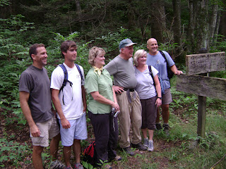
At 0900 several took pictures at the Jakes Creek trailhead; in mine Cecil is between two daughters, one grandson, and one son-in-law. At ~0905 we proceeded on the 0.4 mi. segment of Jakes Creek. Because our hiking group was augmented by members of Cecil’s family and by individuals with whom he worked prior to his retirement (not sure when that was), the pace was easy; knowing this would happen I purposely did not wear my HR-monitor because I knew that I would not endeavor to get an aerobic workout.


Our next trail was a 4.1 mi. segment of Meigs Mtn Trail; it was this trail section that Cecil needed on today’s hike to complete his quest (completing all trails after age 75 in the GSMNP, affectionately labeled a Geezer Map by John Kennerly). When we neared the completion of this segment, Cecil stopped and tried to get those of us who did many hikes with him as he pursued his Geezer Map together so that a picture could be taken by the trail sign. However, his instructions were not heeded since most everyone else stopped too; thus the second picture is of Cecil alone at the trail sign.


The last segment of the hike was the Curry Mtn Trail (3.3 mi.) ending at Metcalf Bottoms. During this segment of today’s hike I was able to talk to several individuals; I sort of went in spurts as I worked my way towards the front of our group, intending to talk to Cecil last. Initially I talked a bit with Joan Tomlinson; she has run a marathon and is now training to run a "trail runners marathon" in addition to completing her 900. I also talked with Missy Kane (not a member of our group but has her own hiking group for Covenant Health and is an ex-Olympian 800 m. runner), Bill Broome (a great guy and a great logistics facilitator for hikes, including this one and in April 07 when I completed my 1st 900), Bill Woodrick (an ex-colleague at UT who got me started hiking), and John Hutsenpiller (a fellow that I got started in hiking). I chose to pass no others for there was (1) a fellow from Channel 10 videotaping Cecil and concurrently interviewing him and (2) a cameraman from The News Sentinel taking pictures (both of the aforementioned activities were done while Cecil was walking the last 0.5 mi. of today’s hike. (In the 8/6 edition of the N.S., I was the 5th hiker behind Cecil, John H. was the last one pictured.) This was followed by a very nice lunch (really a dinner) at The Barn in Townsend. I believe that Cecil was truly pleased with the event even though it cost him a bit. The feat that Cecil achieved today was truly noteworthy; I was pleased that I could be a little part in helping him.

Epilogue: After I told him about today's planned event while we were running 8/3, Craig Wrisberg, who happens to be (1) one of my very best friends, (2) one I first ran with when I accepted employment at UT in '78, (3) one with whom I ran 3X/wk until I retired in '05, (4) one with whom I still run every Monday, and (5) a world-recognized scholar in Sports Psychology, told me, "Wendell, you can be the first one to complete all trails after reaching age 80--I know you can do it." That made me think a little. After the hike today Janetta Baker said that she doubted no else would achieve Cecil’s feat unless I did it. I told her that since I did not start hiking until almost age 71, and although I completed my first map at age 72, rather than seriously work on my 2nd map I just chose to hike and help others complete their maps. Then it dawned on me that had I pursued my 2nd map like I pursued my first map, I would have completed it prior to reaching age 75 yesterday. Then today’s hike would have been my 1st hike on my Geezer Map. One of these days I'll check my blog and see what I have to do to complete my second map; who knows what I will then do?