This blog covers my Smoky Mountain hikes; it also includes a link to pictures from one of my cross country ski ventures.

Tuesday, June 27, 2006

Gregory Ridge (5.0) & Bald (5.3) + 3 mi. Parson Branch Rd


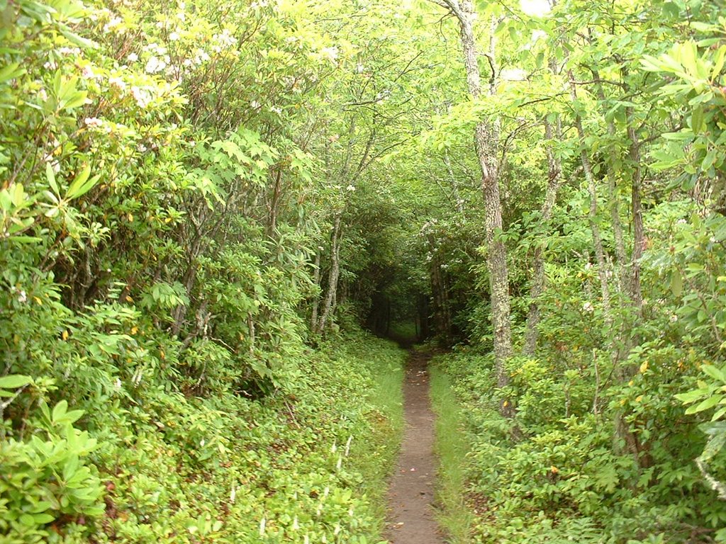
When Lowell Reid and I did Hannah Mtn I saw the trail terminus for Gregory Bald; after looking at the map I put it down as a possible Friday hike. Bill Broome, one of the two individuals that I have been contacting re planning hikes, suggested doing it as a Wed. hike but yet on Tues. so we could get an early start in Cades Cove. It was not until today that I realized why a number of individuals were interested in doing this hike; the azaleas at Gregory Bald were truly fantastic.

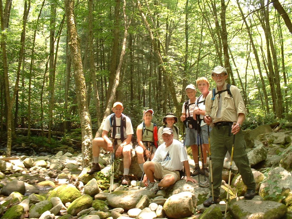
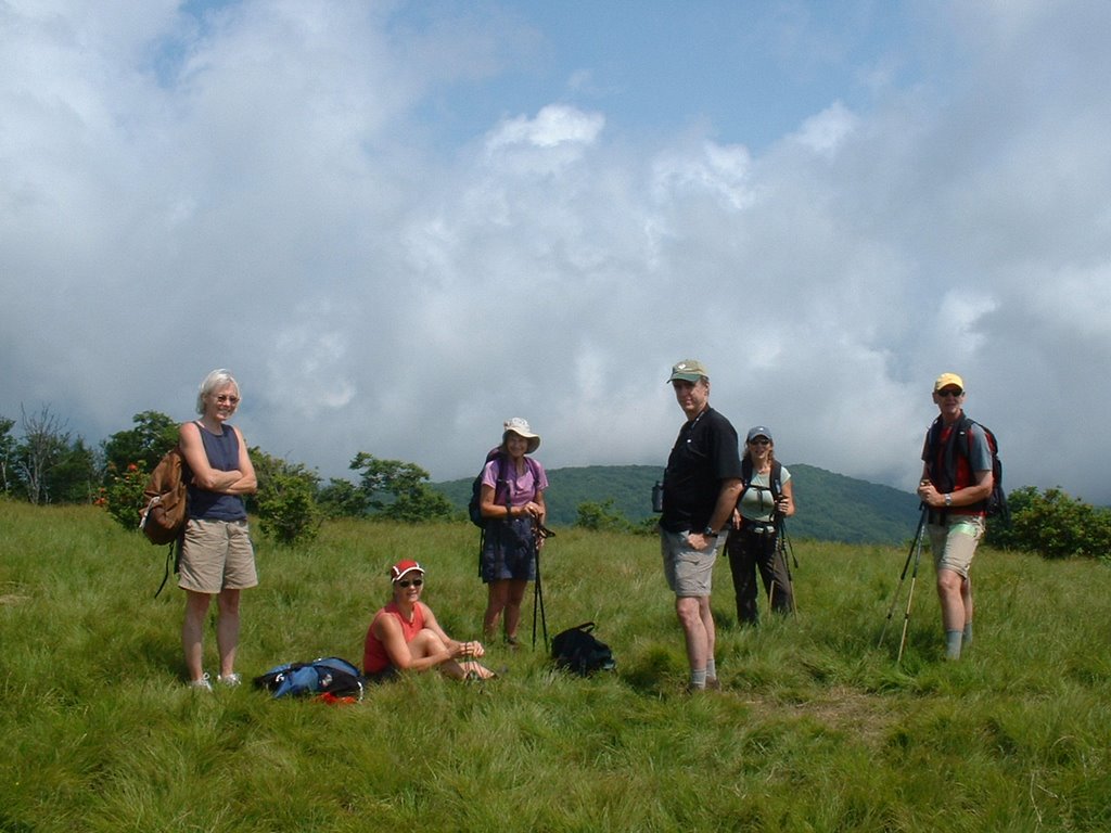
We met at Food Lyon at 7:00 to get a jump on the heat; 5 of us were planning to do the Gregory Ridge & Bald loop plus 3 mi. of Parson Branch Rd; 7 others who were going to do an in and out went in two cars. My riders were Anne, Amy & Tom, and Hope—Bob met us in the Cades Cove Loop. The Cades Cove Loop was ultra slow even at this hour. It was ~9:30 that the 13 of us got started.

On the way up Gregory Ridge Bill Broome led and he and I discussed future hikes and decided to meet at Panera the next day. The pictures speak for the beauty of this Bald. On the way down the six of us sort of got split up; when we reached Parson Branch Rd Bob & Anne waited for Amy & Tom as Hope and I went to my car to ice a knee and an ankle (Hope, a very strong hiker and a new one to me, had turned her ankle.)

Wednesday, June 21, 2006

Sugarland Mtn, Rough Creek, Little River, & Huskey Gap


Only 1.8 miles of this hike out of 15.9 were a repeat for me(Sugarland Mtn—7.2, Rough Creek—2.8, Little River—1.8, Huskey Gap—4.1)

All of our Wed. hikers started at Fighting Creek Gap; most did a 9-10 mi. loop that returned to the starting point via an old road. Eight of us (Bob B., Judy, Diane, Janetta, Amy, Nancy O., Scott—a friend of Bob’s, and I) did a 15.9 mi. hike; although we considered doing a key swap with 4 in each group, the consensus was that we all stay together so we moved two cars to the terminus of Huskey Gap and a third car took us back to our Fighting Creek start.

Some of us did not get started until ~9:30; Sugarland Mtn provided a steady climb. First pic is Scott & Judy at trail head for Rough Creek. After a short distance on Rough Creek we had a nice spot for lunch and a photo op (Bob, Amy, Nancy, Scott, Diane, Janetta, & me). The section of Little River Trail was the only repeat for me. The first 2.1 mi. of Huskey Gap was up and tiring; although the climb was only ~500 ft., it was hot and as I learned the next day, the ozone level was high. The last 2 mi. of Huskey Gap were essentially downhill and I sort of sped to see if I could get to my car before Bob B’s time prediction; I only beat it by 5-6 min. and had expected to beat it by 10-15.

Monday, June 19, 2006

Middle Prong (2.3--old), Panther Creek (2.3), Miry Ridge ((2.5), Lynn Camp Prong (3.7), & Middle Prong (1.8 new & 2.3 old)


Lowell Reid and I got started on this loop ~9:00 a.m.; we did it clockwise. The Panther Creek crossing (an expected water shoe use crossing) was relatively easy to rock hop. However, the trail was a little indistinct and we lost a few minutes determining where it actually was. Miry Ridge got a little tiring with both rain and the climb; the pics show a rhododendrum tunnel and our first sighting of blossoms. Lynn Camp Prong was really nothing to write home about; however, it presented a left turn which the map did not show. After this I took off so that I could ice my knee and Lowell would not have to wait for me. It was not until this point (~where we started the loop with Panther Creek) that we saw anyone else and these were not really hikers; one woman in a family was upset that I could tell them where the Lynn Camp Prong Falls was; I do not remember that from my days working at Sugarlands Visitor Center. I got back to my car at 3:10. (Pics will be added)

Wednesday, June 14, 2006

Meigs Creek (3.5), Meigs Mountain (6.0) (both new) and a little Jakes Creek.


Met at Food Lion at 8:00; the hike scheduled was Meigs Creek & Meigs Mountain plus a smidgeon on Jakes Creek in Elkmont area. I drove to the Townsend Y and my passengers were BJ, Anne, and Bob Hutchins. At the Y I gave my key to Tom and he proceeded to the Elkmont starting point; we in turn went in Tom’s car to the Sinks starting point. Two other cars followed similar paths.

Meigs Creek, according to the Brown Book (i.e., the GSMNP trail bible), has 18-20 stream crossings with the hardest first if you start at the Sinks. Bob counted 19; although one in our group from the other car donned water shoes, all crossings were far from easy relative to rock hopping and there were a few falls (nothing but pride hurt--although not pictured, believe two fell here). At about 11:15 we met the hikers (6-8 in number) that started from Elkmont and we ate lunch together (and swapped car keys as necessary).

Although I had lagged back for most of the first part of the hike, when we came to a hill after lunch I decided I wanted to see how fast I could get my HR to go as I caught up with Charles (one of the few hikers <50); I believe it was only 139 b.p.m.

Monday, June 12, 2006

Hannah Mountain (7.6 new) & Rabbit Creek (2.7 new)


Met Lowell Reid and TJ Tolnas at Food Lion at 8:00. Proceeded in Lowell’s Jeep to Cades Cove and then on to Forge Creek Rd at the West End of the Cove (Forge Creek is a 2-way road). Unfortunately the road continuing SW (Parson Branch Road) is still closed due to storm damage; thus Lowell and I walked ~3 miles on Parson Branch while TJ drove Lowell’s vehicle to Abrams Creek Campground (the terminus of our hike).

Our walk on Parson Branch Rd was mostly up; the map did not show that. Of course that 3-mile section of our hike does not count; however, all the trails covered today were new for me (i.e., 10.3 miles new). Hannah Mountain Trail is relatively modest and pretty trail (see pic). The Brown Book talks about a spectacular tuliptree (Brown Book's spelling--see 2nd pic). Just prior to Hanna Mountain Trail's junction with Rabbit Creek Trail, there's a pretty good climb. Just prior to that we met TJ as he was hiking towards us. Hannah Mountain proceeds in a NE-direction but we turned on Rabbit Creek that proceeds in a NW-direction. This section of Rabbit Creek is fairly easy and we got to its end much sooner than I had anticipated. I could not believe how close TJ had parked Lowell’s Jeep to the trail terminus.

Thursday, June 08, 2006

AT, Dry Sluice Gap, Cabin Flats, Bradley Fork, Smokemont Loop


AT previously done 4.4, Dry Sluice Gap previously done 1.3 & new 2.9, Cabin Flats 0.6 new (& out .6), Bradley Fork 2.3 (previously done), & Smokemont Loop 3.9 (16 mi.total & 7.4 new).

Judy picked me up at the Atlanta Bread Co.; we then proceeded to the usual Food Lion pick-up point at 8:00 a.m. This hike was scheduled for Judy Collins and me; all she needed was Dry Sluice Gap (she'll finish all trail at least by this fall) but I needed the lower 2.9 mi. of Dry Sluice Gap, Cabin Flats, and Smokemont Loop (3.9). Liz took care of logistics; it was complicated because we began our hike on the AT from Newfound Gap and finished at Smokemont Campground. Although 9 of us started at Newfound Gap ~10:00 a.m., Judy, Manfred, Jim, Betty and Nancy did a little shorter route than Bob B., Charles, Karen, and I.

The AT sections we did I have done several times. Dry Sluice Gap (old & new sections) were not particularly unique except for the large tuliptrees (see pic). The most exciting thing about the Cabin Flats section (besides cooling one's feet)was the dead rattler we found next to the trail. Smokemont Loop presented a fair climb for the first portion (~1200 ft); this is not a particular delightful task at the end of the day. When we reached the trail’s terminus we had to study the map to determine which road would take us to the campground. Arrived home ~7:15 p.m.