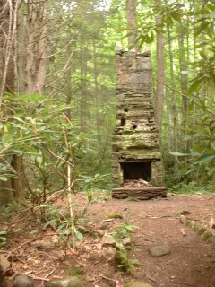
This blog covers my Smoky Mountain hikes; it also includes a link to pictures from one of my cross country ski ventures.

Wednesday, August 30, 2006

CD Bypass, Forney Ridge--4.5N, Sprnghse Branch--4.2N, Forney Creek--1.3PD, Whiteoak Brnch--1.8PD, Lakeshore--1.3PD, Tunnel Bypass--1.2 N (13.3 mi)

Met at Food Lion at 7:00; Amy and I drove to Sugarlands. Amy and Richard Ryburn (a new hiker) were doing Noland Divide and Noland Creek; I picked up 3 of her passengers and had 6 in my car for the 1-2 miles to Clingmans Dome. (Six from Gatlinburg whom I did not know had started on Noland Divide about an hour earlier; Bill Broome, Bob Bolinger, Bill Woodrick, John Kennerly, and Tom Wainner would follow later. I felt quite comfortable about this contingent of 13 for the hikers that I knew would ensure that everyone finished.)

My group (Jim Harb, Lowell Reid, Ellie Doughty, Cecil Rowe & Jim Carmon—new to our group) got started about 9:00. Frank & Peggy Jaskolka and Barbara Slover & Martha Frink had started on the same route about 60 and 15 min. earlier, respectively. The Forney Ridge trail has a few rocks, in parts an exceptional amount of growth, plus a 2,300' descent--not my favorite type of trail.

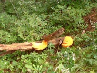
On Springhouse Branch Jim Harb, Jim Carmon & I were behind only Frank and Peggy. It was on this trail that we ran across two unique examples of "orange mushrooms"; as you see I got a good picture of the pair but a horrendous picture of the bunch--in your mind’s eye you’ll have to transform the goof to the good one.

We ate lunch when we reached a campground near Whiteoak Branch. At this point the Jim H & C went South on Forney Creek while Lowell, Ellie, Cecil and I took the hypotenuse. Frank & Peggy were close behind us and Martha & Barbara were a little further back (these 4 would be going through the Tunnel to Nowhere, a shortcut). The four of us met the two Jim’s on Lakeshore. When we came to Goldmine Loop, Ellie (who has completed all trails) volunteered to go with Jim H. on Goldmine Loop--a very difficult trail; the remaining four of us needed Tunnel Bypass (although I had done Goldmine Loop when I backpacked, I had completed only a segment of Tunnel Bypass). I decided to speed up and arrived on Lakeview Drive ~3:50; thus the hike took me close to 7 hours. Frank and Peggy were coming out of the tunnel about the same time that my cohorts finished. Shortly thereafter Barbara and Martha came out of the tunnel about the same time that Ellie and Jim had finished Goldmine Loop.

The bus was supposed to arrive at 5:00 but was a little late; when it did arrive it had picked up the 13 who had done Noland Divide & Noland Creek. With 23 riders we needed to charge only $7 each; that was great! On the way back Bill Woodrick and Jim Harb collected the money for me while Bill Broome and I planned next week's hike.

Wednesday, August 23, 2006

Big Creek--5.1, Swallow Fork--4.0, & Pretty Hollow--5.6 (14.7 mi)


Today’s hike was at Cataloochee; all trails were new for me. In part because I was the only one from Blount Co. making the hike, I drove to Cracker Barrel at Strawberry Planes on I-40 to meet the 5 Knoxville people making the hike (K-hikers often meet there rather than Food Lion in Maryville). Because John Kennerly told me that it would take ~1 hour to get there, I left at 6:30. Much to my surprise I arrive there in 20-25 min.; Bill Broome was having breakfast and I had a cup of coffee with him and the others arrived shortly.

John and I went in Cecil Rowe’s car, parked it at the N-end (Big Creek Campground area) and we hiked the trails in the order given above. Cecil drove my car, with Bill Broome, Bill Woodrick, and Lowell Reid as passengers; they parked it at Southern terminus of the hike described above and went North (their overall altitude gain was ~900 ft. less than ours). John and I met the others after we finished Swallow Fork and they had finished Pretty Hollow (in ~3.5 hours); we made pretty good time for we both are relatively fast hikers. At this point we swapped car keys and I had mine again; this is also where I took a picture of my hiking buddies.

Pretty Hollow trail was not as much fun because you are going downhill and often having to step on loose rock. We finished the total hike in ~6 hours. We then got in my car and I let John drive while I iced my knee; this is the area where the elk are and much to our surprise 6 were adjacent to the road. John stopped my car and I took this picture as well as a few others. I then dropped John off at Cracker Barrel ~5:15; rather than face the Knoxville traffic I decided to eat there. My car miles from home to Cataloochee and back to home were 219; although all 14.7 miles of trails hiked were new (no repeats), I would like to backpack in this area since it truly requires a long drive.

Friday, August 18, 2006

Hazel Creek--~1.0 n, Cold Spring Gap--3.5 pd, Welch Ridge (& High Rocks)--1.8 n, Bear Creek 5.9n, Lakeshore--1.4 n & 1.9 pd (15.5 mi.)

Granola and blue berries did not taste that great two days in a row. We proceeded S. on Hazel Creek to its junction with Cold Spring Gap (that 8.1 mi. finished Hazel Creek for me). About 0.5 mi. in to Cold Spring Gap we donned our water shoes and waded across Hazel Creek. We then had 3 mi. of Cold Spring Gap up; I told Dennis if we were lucky we would get there by 11:30 but it would probably be closer to 12:00. I decided to get it over with and arrived at the junction of Welch Ridge at 11:38. Prior to today Cold Spring Gap going down (mostly westerly) was my least favorite trail; I must say that although there was a 2,000 ft. elevation gain going up, it was no more difficult. This trail has sections in which you continually are stepping on rock; to me stepping up on rock is easier than stepping down on it (latter requires eccentric contraction of leg extensors also—my R-knee does not like negative work).

I ate lunch and when the others arrived we proceeded up Welch Ridge 0.9 mi. (PD). About half way there I took the 0.4 jaunt to High Rocks; this trail’s overgrowth really bloodied up my hands (plus a little on the arms & legs); I decided that in the future I would carry my old weight lifting gloves in my bag to protect the backs of my hands should I encounter similar trails.

At the junction of Bear Creek trail I met Dennis and Joel and we proceeded down latter to its terminus (5.9 mi.); this was a fairly easy trail. We then did a 2.9 mi. section of Lakeshore that was mostly up; although I had done this one a couple of times previously, with a 30+ lb. pack at the end of the day made it a little tiring. Extremely glad to see the tunnel; I got home ~8:00, having survived my first backpacking trip.

Thursday, August 17, 2006

Jonas Creek--4.1 pd, Welch Ridge--0.7 pd, Hazel Creek--~7.1 n (11.9 mi)

My breakfast was granola and blueberries, for this you just pour water in the bag—it too was good. We all went up Jonas Creek (4.1—PD), and 0.7 of Welch Ridge (PD). Dennis and I then went down Hazel Creek to Campsite 82 (~6.2 mi.—Joel went down Welch Ridge & then Cold Spring Gap & then up to meet us—his was a killer). That evening I had beef goulash in the bag—it was really good. Did not sleep well.

Wednesday, August 16, 2006

Tunnel Bypass, Goldmine Loop--2.0 n, Lakeshore 1.3 pd & 1.4 n, Forney Creek--1.1 & 2.5 pd (7.0 mi)

Met Joel Morris and Dennis McAdams at 8:00 at Sugarlands. We volunteered to chip in for gas; Dennis drove and we arrived at the tunnel about 9:30.

We did the E-part of the Tunnel Bypass trail (0.4), Goldmine Loop (2.0), 1.3 mi of Lakeshore (PD)--at this juncture Joel went up Whiteoak Branch and Dennis and I did 1.4 mi. Lakeshore (N), 1.1 mi. section of Forney Creek (N), met Joel and then we all did ~2.5 mi. of Forney Creek (PD) and set up camp at Campsite 70. There’s the adage that the 1st hiker alerts the yellow jackets, the 2nd makes them mad as hell, and the 3rd gets stung. Dennis was leading and got stung once, Lowell was 2nd and got stung twice, guess who got stung 3 times?

My little one-person Sierra Design tent is light; however, you have to be a gymnast to turn around in it. Had a freeze-dry meal of chili and pasta—not too bad particularly when all you do is pour hot water in a bag, zip up and wait a few minutes, and then eat out of the bag. Besides forgetting my camera and pedometer, I should have brought reading material as did the others. It rained a bit too.

Wednesday, August 09, 2006

Kanati Fork--2.9 and Kephart Prong--2.0 (both in/out, 9.8 total miles)


Had planned on having a long hike today from Cades Cove to Fontana (18.3 for some, 22.3 for a few of us); however, because of key swap logistics and hot & humid weather I cancelled it. The Kanti Fork and Kephart Prong were trails that I needed; initially Bob Bolinger and I were going to do them alone; however, by Wed. a.m. we had 8 (BZ, Dale, Janetta, Diane, Amy, & Allen).

Kanati Fork presents a 2,100 ft. climb in its 2.9 miles; BZ and I did this in 76 min.(see pic). This hike took its toll on a few; however, in going down everyone kept within a reasonable distance of each other. We then walked down U.S. 441 and ate our lunch by the bridge over the Oconauluftee River and trailhead of Kephart Prong. This is an easier trail (although rocky) and we took it more at more of a leisurely pace; a remnants of a Civilian Conservation Corps Camp (in use 1933-42) and a shelter were highlights.

Wednesday, August 02, 2006

AT--2.4 PD, Goshen Prong—7.7 N, Little River—3.4 PD

I originally thought that I would have to go up Goshen Prong with whoever would volunteer so that we could do a key swap. However, on Monday Bill Broome advised me that he had volunteers to move cars from Clingmans Dome to Elkmont; at 8:00 at Food Lion there were even more volunteers if we needed them. We left for Clingmans Dome in three cars from Sugarlands (12 hikers and 3 car movers) at ~9:00; my passengers were Dave Wayland (who had volunteered to drive my car to Elkmont) and Bill Broome, Mike Miller, & Dale Teague. At about 10:15 we began our hike.

Two hikers took the lower trail segment to get to the AT while 10 of us took the upper. When we reached the Goshen Prong trailhead some of us waited for the two but to no avail. The group that I was in (Bob Bolinger, Diane Scarbrough, BZ Lane, Cecil Rowe) then proceeded down Goshen Prong and reached Campsite 23 ~12:45 where our first contingent was just finishing their lunch. Just as the latter were about to leave, our two hikers caught up with us; I was very thankful. My group left shortly thereafter; after a couple of miles I decided to go a little faster so that I could ice my knee without having to keep my riders waiting at Elkmont. At 2:12 I finished the last leg of Goshen Prong (3.3 mi) and hit out on the 3.4 mi. section of the Little River trail. I motored here and caught the last of those who started earlier; I arrived at my car at 3:14 p.m.