This blog covers my Smoky Mountain hikes; it also includes a link to pictures from one of my cross country ski ventures.

Thursday, April 27, 2006

AT 1.7 from NFG, Sweat Heifer 3.7, Grassy Branch 2.5, Dry Sluice Gap 1.3, AT 4.4


Did this hike with Bob Bolinger. Although above sections of AT had been done previously, 7.5 miles of non-AT trails (all new) covered today.

We got a late start; completed: 1.7 mi. of AT at 12:18, 3.7 mi. of Sweat Heifer Creek at 14:05, 2.5 mi. of Grassy Branch at 15:15, 1.3 mi. of Dry Sluice Gap at 15:57, and 4.4 mi. of AT at 1800. My pedometer was very close with respect to miles (14.05 & 14.1 covered).

One trail sign is pictured as well as one pic from Charlies Bunyon.

Monday, April 24, 2006

Crooked Arm Ridge 2.2+, New: Scott Mtn 3.6, Chestnut Top 4.3


When I arrived at Food Lion at 7:50, Anne & BJ, Janetta, and TJ were there. When we arrive at the Y in Townsend, everyone got in my vehicle and I proceeded to the trail head that led to Crooked Arm Ridge trail in Cades Cove ~8:45. The first part of the trail was tougher and one moved a little slower. Scott Mtn was fairly easy and most on the park boundary; I arrived at the picnic table (50 ft from a private house) ~12:15 and started icing. We then went ~0.3 miles and hit the trail head for Chestnut Top; it was fairly easy too for most of it was level or down. Janetta and I led the way; by so doing she was able to drive me to the Cove to pick up my car and then she could return to pick up the others at the Y. Pictures taken include Bote and possibly Thunderhead Mountains; one flower pic is also included.

Friday, April 21, 2006

Rich Mtn--2.3, Indian Graves Gap--0.8 old, 1.1 new


Because of threatening weather, last evening I rescheduled Friday's hike to Monday. It was probably a good idea because it was raining heavily at our planned 8:oo mtng time. By noon it looked OK; I decided to do Indian Gap starting at the park's boundary at Rich Mtn Rd. (Bob Hutchins mentioned this as a possibility when I helped him with trail work on his section of the AT on 4/13.)

I started Rich Mtn trail at 14:15 and finished the 2.3 mi. in 55 min.; it was mostly uphill and I motored (I had promised Meredith that I'd go with her to a house showing at 17:30 since the info she had on the buyer raised questions). Next was a repeat of 0.8 mi. of Indian Graves Gap trail (13 min.) that I had done previously; then a 1.1 mi. new section of Indian Gap (21 min.). Then I reached Rich Mtn Rd. and really tried to motor (3 mi.+ in 63 min.). I had wanted to reach my vehicle at 16:45; it was 16:47. (Trails were not scenic enough to make stops so I primarly took pictures of trails signs.)

Wednesday, April 19, 2006

Lead Cove--1.8, Turkeypen Ridge, Schoolhouse Gap--3.3

Because our long hike on Springhouse Branch was cancelled because of expected heavy rain, I went with another crew (Barb, Amy, Diane, Janetta, and Bob B.) planning to do a loop near Cades Cove. We did Lead Cove & Turkeypen Ridge--I had previously done latter. However, we were getting soaked when we reached Schoolhouse Gap. At this point Barb and Amy retraced our steps to the car; the rest of us went North on Schoolhouse Gap to the border of the Park and then retraced our initial steps and then took Schoolhouse Gap to Little River Road.

In about 30 min. Barb and Amy picked us up; we then proceeded to the Back Porch for lunch.

Friday, April 14, 2006

Road Prong (6.6 miles--3.3 count)


Hiked with BJ and Bob Perlach. BJ has finished her 900 miles but Bob has a few to do; hope to join them again and possibly in backpacking too.

The trailhead is on U.S. 441 below Newfound Gap. The first 0.9 miles of this trail will be repeated when I do the Chimneys; the next 2.4 is moderate. Much of the trail goes along creek beds; in the last part there is a little bit of climb. The 3.3 miles ends at Indian Gap; this is a small parking area on the road to Clingmans Dome adjacent to the Applachian Trail.

Wednesday, April 12, 2006

Porters Creek Trail (2.7 miles new, 7.4 actually hiked)


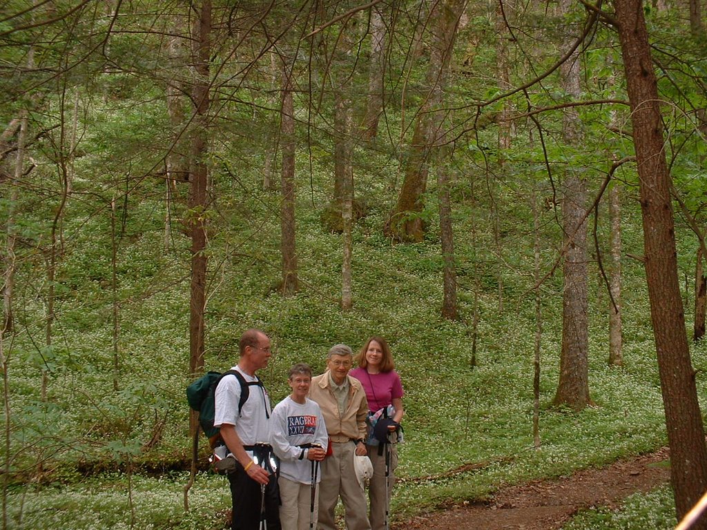
It is my understanding that this hike is typically chosen this time of year because of the flowers on Porters Creek. Thus although it is a shorter hike than my faction of the Wed. group typically does, it was scheduled and Derl's group (those typically doing the shorter Wed. hike) joined us.

A host of people were at Food Lion; BJ had brought Cathryn & Bob (who recently moved from Iowa) and I offered to take them as well as Glen Marshall. Of the Food Lion group we were the first to arrive a Green Brier to begin the hike; we subsequently learned that some from the Knoxville subset of our group had arrived earlier. Many others also elected to do this trail because of the flowers that this trail presents at this time of year.

Although the hike was short, BJ and Glen identified many of the flowers that were in bloom as well as many others which were about to bloom. They really know the flora of the park. Today I forgot to bring my pedometer; with all the flower stops I had no clue on our mileage covered. Thus a short hike took much longer than my body thought it would take because once I get to a trail I typically move out unless I let someone else set the pace.

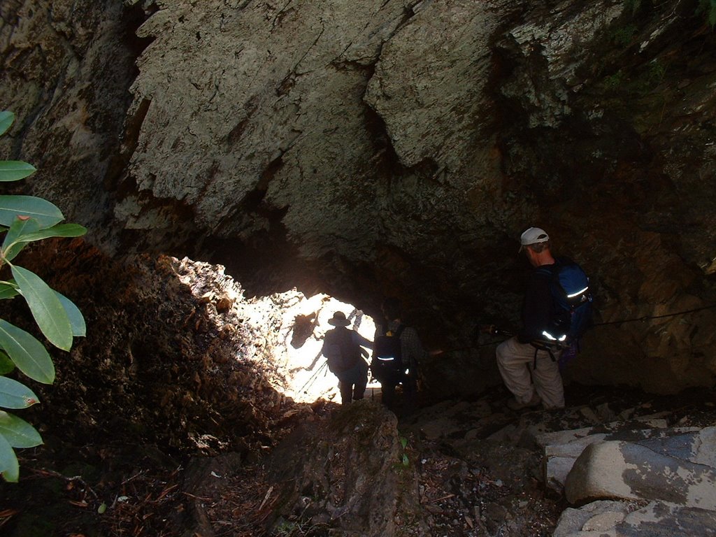
The pictures include (1) our group and (2) a 19th century cantilever barn that was in relatively good shape.

Wednesday, April 05, 2006

AT, Boulevard Trail to LeConte, & Alum Cave Bluff Trails (10.4 mi. new trails, 2.9 old)


We met at Food Lion at 8:00; because most of us were going to do the Boulevard Trail (which starts at Newfound Gap on US 441) to LeConte and then return via the Alum Cave Bluffs (ACB)Trail back to US 441 (~4 mi. below the Gap) , logistics were important. Thus I alone rode with Mike Miller; when we got to the ACB trail head we picked up 5 others and another 2 cars also went to the Gap. (Mike returned to the ACB trail head and met up with ~6 others and they proceeded to LeConte.) The rest of us proceeded on the AT from Newfound Gap for a distance of 2.7 (in the first pic you can see US 441 in NC). At this point we hit the Boulevard Trail (a favorite trail of Debbie Way) and after an additional 5.4 miles we reached LeConte. A few sections of the trail still had ice and one had to be cautious.

LeConte was now open for hiking tourists (in my 2 prior trips in Jan. with Joel & Feb. with Jim it was closed). There we met Mike et al. who had taken the shorter ACB trail to LeConte. Because Nancy, Debbie, and I were the first ones from the "Gap" group to reach LeConte via the Blvd. trail; we were ready to leave with Mike as the others began arriving. The ACB trail also had sections of ice; however, wherever there was a drop-off there was a cable attached to the rock wall adjacent to the trail (I definitely held on to this when there was ice on the trail). About 1.5 miles from our terminus is a rather unique tunnel/cave (Nancy, Debbie, & Mike appear in the pic). We covered this 5 miles in ~100 min.; at the trail head Mike took Nancy and Debbie to Newfound Gap to enable them to drive two cars back to the ACB trail head.